Wednesday, December 29, 2010

nz day 8: abel tasman adventure continues

Kristin's journal entry: "On Day 2, we woke up with the trumpet again and then set out.  We kayaked to Bark Bay for lunch.  It was awesome - the ocean was shallow for a long way out, so it was perfect for wading.  We watched a cute duck family while we ate (I named them the Armbrusters).  The duckling would jump to try to get seeds and then fall over.  Finally he learned that he could walk over the top of the plant to get the seeds to his level.  He was so cute."

 
Morning of Day 2

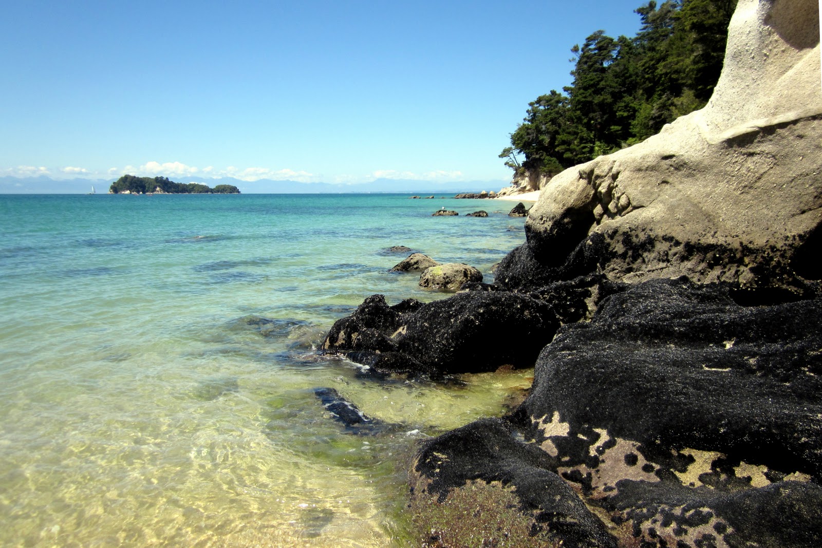
 Stopover at Bark Bay.


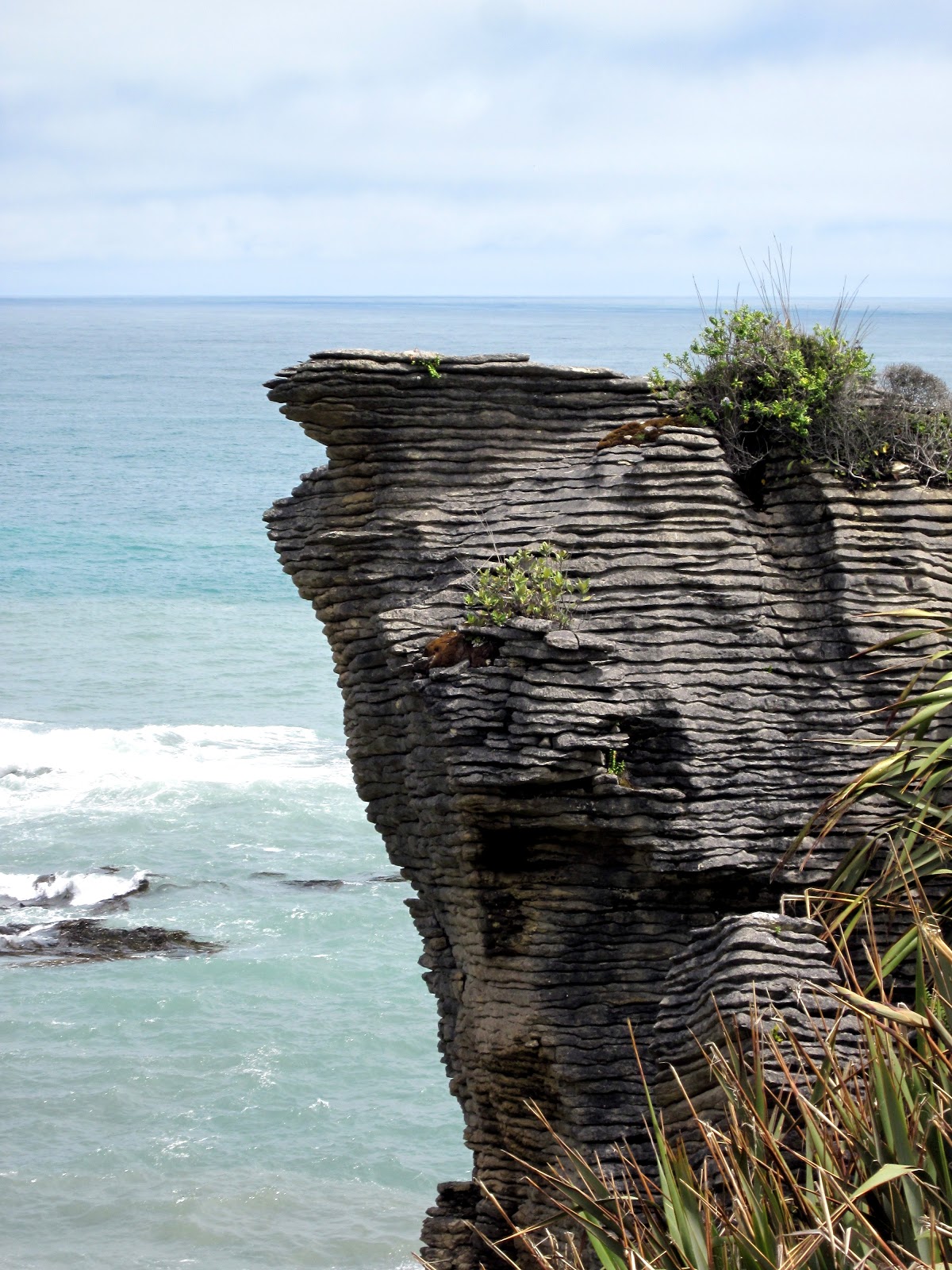
 Nathan's journal entry: "I decided to go shoeless on the second day to avoid further rubbing, and that helped significantly.  However, I neglected to adjust the rudder pedals to compensate for the lack of shoes.  That combined with my lower back soreness meant that I was eager to get moving and cover as much distance as possible.  Unfortunately, that meant that I rushed through much of the trek without paying much attention to the beautiful scenery.  But, the stop at Bark Bay for lunch was beautiful.  I got the pedals adjusted properly after lunch, and I was actually comfortable.  Too bad we just had the rocky, rough sea ahead, so I had to push ahead again until almost the end.  I did take a little time to enjoy Arch Point.  That was an awesome set of rocks, but I was scared to try landing the kayak there amidst the rocks near high tide.  So in the end, I noticed more of the coast we passed that day when riding back on the water taxi." 


 This beautiful sand became the bane of our existence.

Kristin's journal entry: "We kayaked across more choppy water, almost capsizing on a sandbank near Arch Point and getting stuck on a shallow rock.  We managed to stay in the kayak by embracing the wave (leaning towards it).  We dropped our boat off at Onetahuti and laid out on the beach while we waited for the water taxi to pick it up."

Laying out on the beach!

The kayak waiting to be picked up by the water taxi.


We had some crazy tans on our feet by the end of the trip.

Kristin's journal entry: "We then had to hike to Awaroa with all of our gear (including what looked like a Santa sack with gear from the kayak company).  Nathan thought it was a 20 minute walk, but it actually took us over 2 hours.  We did some of it barefoot since we had to wade through tidal pools.  I found lots of great shells in the process (including one that still had a clam in it and stunk up our bag the next day).  When we arrived at the campsite, our feet hurt, we were tired, our extra clothes were all wet, and we were really dirty.  But it was a beautiful campsite, and we were the only ones there.  The only downside to the place was the overpopulation of sand flies."

Nathan lugging his load at the beginning of our hike.

One of the tidal inlets that we had to wade across.

Nathan's journal entry: "The walk to Awaroa was the most tiring and frustrating part of the trip.  The Onetahuti low water crossing was not well marked, and the trail signs further along were faded beyond recognition.  We took an official shortcut, and that was not well marked either.  And, because we had way more equipment than our small backpacks could hold, we had a 'Santa' sack and a plastic bag full of wet clothes to carry.  We were both worn out by the time we got to the camp, and our feet had taken more of a beating.  We took our shoes off for water crossing and sand, and I had a crab tickle my foot when I was standing on his hole (I could not avoid standing on some crab holes with how many there were).  I'm guessing he just wanted to come back outside."

 Nathan and his Santa sack after about 1/2 hour of hiking barefoot.

Nathan's journal entry: "The campground was beautifully manicured with a great kitchen space, and it was completely empty...except for tons of sand flies and mosquitoes that ignored bug spray."

The campsite had a nice kitchen shelter with running water and sinks for washing dishes.

Sunset at the campsite.

Our tent at the nicest campsite we've ever stayed at.  We were the only ones there!

Tuesday, December 28, 2010

nz day 7: abel tasman adventure begins

We had stayed the night in the Fellworth House in Nelson.  This house is an old mansion that has been turned into a hostel.  It was pretty interesting but not a place to stay for several nights.  It is a hostel, after all.

 Our bedroom in the Fellworth House.

Fellworth House

Kristin's journal entry: "The next morning (Nov. 28), we got up bright and early to drive to the Sea Kayak Company.  We checked in with a woman who was making an evil fairy costume for a Christmas party (weird!).  Our guide was really fun.  She was impressed (and slightly worried) by how little we packed, but we got a smaller plastic kayak as a result.  She taught us and two other couples the basic instructions and safety procedures, and we were off on our own by 10:30."

Nathan became a master kayaker. :-)

Nathan's journal entry: "Sea kayaking at Abel Tasman was a great experience, but not one that I plan on ever repeating.  Kayaking was less strenuous than I had expected.  I knew that my shoulder was sore from only two hours of rafting in Queenstown, and Kristin got sore after only one hour of kayaking in Sacramento, so I was planning for very sore arms.  While Kristin's arms were really sore the first night, she did really well on the second day and didn't mention any arm soreness after that.  My arms never got sore because it was easy paddling.  What made it tough for me was sitting in that tiny seat with pressure on my lower back.  So discomfort was one part I can live without, but the main drawback was that the whole experience was nerve-wracking!"


Kristin's journal entry: "Kayaking was harder than I think we both expected because of the waves and the sea breeze.  My arms were practically numb by the end of the day, especially after the Mad Mile (an area with exposed headwinds).  Our boat bobbed like crazy.  We stopped at Stilwell Beach for a bathroom break, Watering Cove for lunch, and then Te Pukatea for a break.  We saw a few penguins, lots of water birds, and one seal.  From Te Pukatea, we hiked to Pitt Head to get a better view.  There's a funny "lighthouse" close by - it's basically a light bulb propped up by some boards."

Kristin maintains that these are penguins.  Nathan isn't so sure.  If you think Kristin is wrong, please don't tell her...she likes penguins too much to bear that disappointment.


We called this Kiwi Rock because it looked like a kiwi bird!


Nathan actually smiled for this photo!

Nathan's journal entry: "I was steering trying to stay close to the shore for protection from waves while avoiding rocks that were sometimes hidden behind successive waves (those would pull the kayak closer to them with the way the waves moved around them).  Steering also meant being mindful of the waves so that they did not push us into rocks or hit us directly from the side even when we were headed perpendicular to the direction the waves were traveling.  There were so many things that could go wrong that I rarely felt comfortable outside of the peaceful coves, especially once I realized that those mild ocean waves that were barely forming white caps were taller than our little kayak and could toss us around if we were careless.  Despite that, I enjoyed most of the kayaking because the Abel Tasman coast is rugged and beautiful and needs to be seen from the water."


 Nathan's journal entry: "The first day was gorgeous, and we stopped at several beaches.  With all the getting in and out of the kayak, followed by the walk to Cleopatra's pool (which has a pretty awesome natural spillway), sand had rubbed parts of our feet raw, primarily in the arch of the foot.  My right foot bled a little that night, but it wasn't bad.  The views and experience were worth it.


View from Pitt Head.

The paths right off the beach were gorgeous!

This photo shows the "lighthouse"...can you find it?  Hint: top left corner.


Kristin's journal entry: "We kayaked to Anchorage to camp for the night.  It was a pretty beach, but unfortunately, there were a lot of baby penguins that had died and washed up on shore.  After setting up our tent, we hiked to Cleopatra's Pool.  It was a pretty hike, but we got sand in our shoes, and our feet got really raw.  The camp itself was a really nice one and fairly quiet considering the number of people there.  A large group of teenagers was there, but they all went to bed after a trumpet played something similar to Taps.  It was a powerful trumpet!"


Lovely stream along the walk to Cleopatra's Pool.

Cleopatra's Pool

Natural water spillway running into Cleopatra's Pool.

Saturday, December 25, 2010

nz day 6: across the south island and back again

We left Christchurch bright and early for a ride on the TranzAlpine train.  The train took us on a 4-hour journey over the Southern Alps and dropped us off on the other side of the South Island.

Map borrowed from http://www.tranzscenic.co.nz/services/tranzalpine.aspx.

We both enjoyed standing in the open-air train car and taking pictures, but it wasn't long before Kristin realized that she was allergic to the mountain air.  After lots of sneezing, she went inside to view the sights through the windows while Nathan continued as the trip's official photographer.

Approaching the foothills.

Canterbury Plains meeting the foothills.
Nathan's journal entry: "The train to Greymouth was scenic but not quite as scenic as I had hoped.  The best views were of a river that the train followed.  The mountains were pretty, but they were the rolling kind (as opposed to rocky and jagged) that don't make for great pictures."
 
The Waimakariri River


Kristin's journal entry: "The ride was stunning, but I spent most of it sneezing.  Fortunately, you didn't have to be in the open-air car to get good views."


The train dropped us off in Greymouth, a small town on the west coast of the South Island.  Please keep Greymouth in your prayers.  They were the center of the recent national mining tragedy, and we visited there right in the midst of it.  From Greymouth, we proceeded to drive back across the South Island to the city of Nelson.

Kristin's journal entry: "We rented a car in Greymouth and first drove to the Pancake Rocks - they are so cool!  The drive was amazing - just like what I've always thought Hawaii would look like.  It was very tropical and rainforesty, and we hit it just at high tide." 

The coast along Highway 6 reminded us of California's Highway 1, but it was way better.

Nathan's journal entry: "...the drive up to Nelson was long but great.  The stretch up the coast was like California's highway 1, but with cool rock formations and mountains and rainforest.  Then there was the Pancake Rocks walk.  I was skeptical of their amazingness, but the rocks were definitely worth the stop."

The Pancake Rocks (or more officially, the Punakaiki Rocks) provided some great views of the coast.

We got to see the Pancake Rocks up close.  They get their name from the layers looking like stacks of pancakes.


The continually changing waves, combined with the layered characteristics of the rocks, have created some amazing formations.

Kristin is silly for putting this picture in here, but that tree had some crazy big spikes on it.


With a bit of imagination,you can find faces and animals in the rock formations.


Nathan's journal entry: "Farther north, we got some great views of the Paparoa Mountain Range as the highway turned back inland.  Unfortunately, the turnouts had lousy views, and the great views were from spots where we could not stop for pictures.  After that, though, the drive got really tedious with one-lane bridges where we could not see oncoming traffic, narrow gorges where we had very limited view of the mountains, and winding roads."

We followed the Buller River inland.  This area is renowned for fly fishing and rafting.

We were treated to a one lane section of road starting around that bend where we couldn't see oncoming traffic.


The narrow roads continued for a ways until we got to Murchison, where we came out in a wide valley.

The sun shone through the clouds to light up the green valley and mountains while it was still raining.

Kristin's journal entry: "The drive to Nelson was beautiful but a bit winding for my tastes.  I was glad to get to Murchison in the valley.  It was raining, and we saw 4 rainbows at once!  One was inverted, and the other 3 were stacked on top of each other.  We chased them for a good half hour."

Notice the dim rainbow on the left with red on the bottom and blue on the top?  And if you enlarge the image, you might make out all three sets of color bands for the main rainbow (it is clearest in the upper right corner).